
Build the next generation of Cambodian geospatial professionals.
Hands-on training in GNSS, drone mapping, GIS and surveying software — taught by working field engineers with real equipment, real datasets, and recognized certificates.
A modern academy for surveyors, engineers and mappers.
The EZ Surveying Academy is Cambodia's dedicated learning center for geospatial technology. Our programs blend classroom theory with extensive field practice — so graduates leave job-ready, not just certificate-ready.
- Industry-aligned curriculum reviewed every term
- Real survey-grade equipment for every student
- Small cohorts with 1:6 instructor ratio
- Khmer & English instruction available
Open enrollment cohorts.
Stack courses into career-ready credentials.
Field Surveyor
- GNSS-101
- TBC-310
- Field Workshop
Drone Mapping Specialist
- UAV-220
- Photogrammetry
- Point Cloud Lab
GIS Analyst
- GIS-150
- Spatial SQL
- Web Mapping
Six specialized tracks. One academy.
Whether you're starting in the field or scaling a survey department, each track combines theory, software labs, and field practice.
DGPS & GNSS RTK
Master differential GPS, base/rover setup, NTRIP, RTCM3, and centimeter-level RTK workflows.
Drone Mapping
Plan and execute photogrammetry & LiDAR missions with DJI M350 RTK and Zenmuse L2.
GIS Fundamentals
Build spatial databases, perform analysis, and publish maps with QGIS and ArcGIS Pro.
Software Training
Hands-on with Trimble Business Center, AutoCAD Civil 3D, Global Mapper, and CloudCompare.
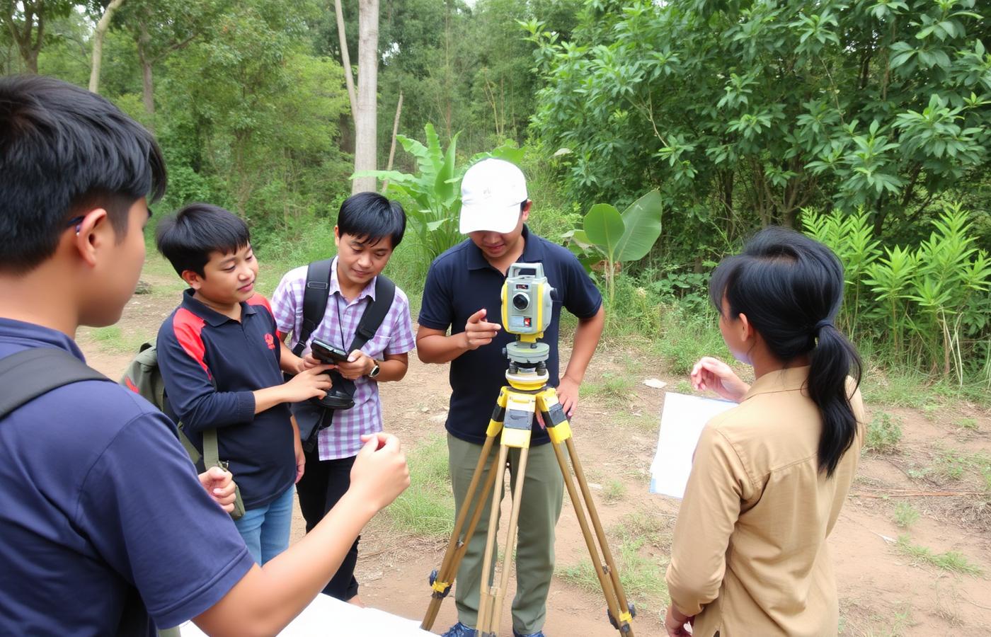
Field Workshops
On-site practice: control networks, topographic survey, stake-out, and as-built capture.
Point Cloud & BIM
Register, classify, and convert LiDAR point clouds into BIM-ready deliverables.
From classroom to construction site.
"The RTK course made network corrections finally click. I went back to site and cut my fieldwork time in half."
"Best LiDAR training in Cambodia — instructors are field engineers, not just lecturers. Real projects, real data."
"Clear curriculum, modern lab, and certificates that actually mean something to employers."
Train your team. Modernize your workflow.
Custom corporate training, on-site at your office or our Phnom Penh academy. Group rates available for 5+ enrollments.