The technology behind centimeter precision.
From multi-constellation GNSS to LiDAR processing — the systems we operate are engineered for resilience and accuracy.
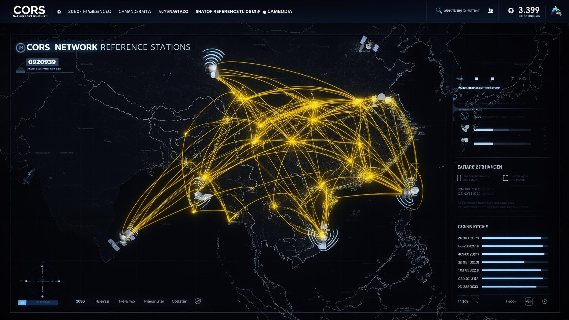
A national reference network, always on.
Continuously Operating Reference Stations distributed across Cambodia, broadcasting RTCM corrections to your rovers in real time — backed by 24/7 monitoring.
Request CORS accessNetwork status
All systems nominal< 1s
Latency
10mm
Accuracy
4
Constellations
99.9%
Uptime
PNH-01
Phnom Penh
SRP-02
Siem Reap
BTB-03
Battambang
KPS-04
Kampong Som
From sensor to deliverable.
Capture
GNSS, LiDAR, photogrammetry — multi-sensor data acquisition in the field.
Ingest
Secure upload to processing infrastructure with full project versioning.
Process
Adjustment, georeferencing, classification and quality assurance.
Deliver
BIM, CAD, GIS and report-ready outputs in your preferred formats.
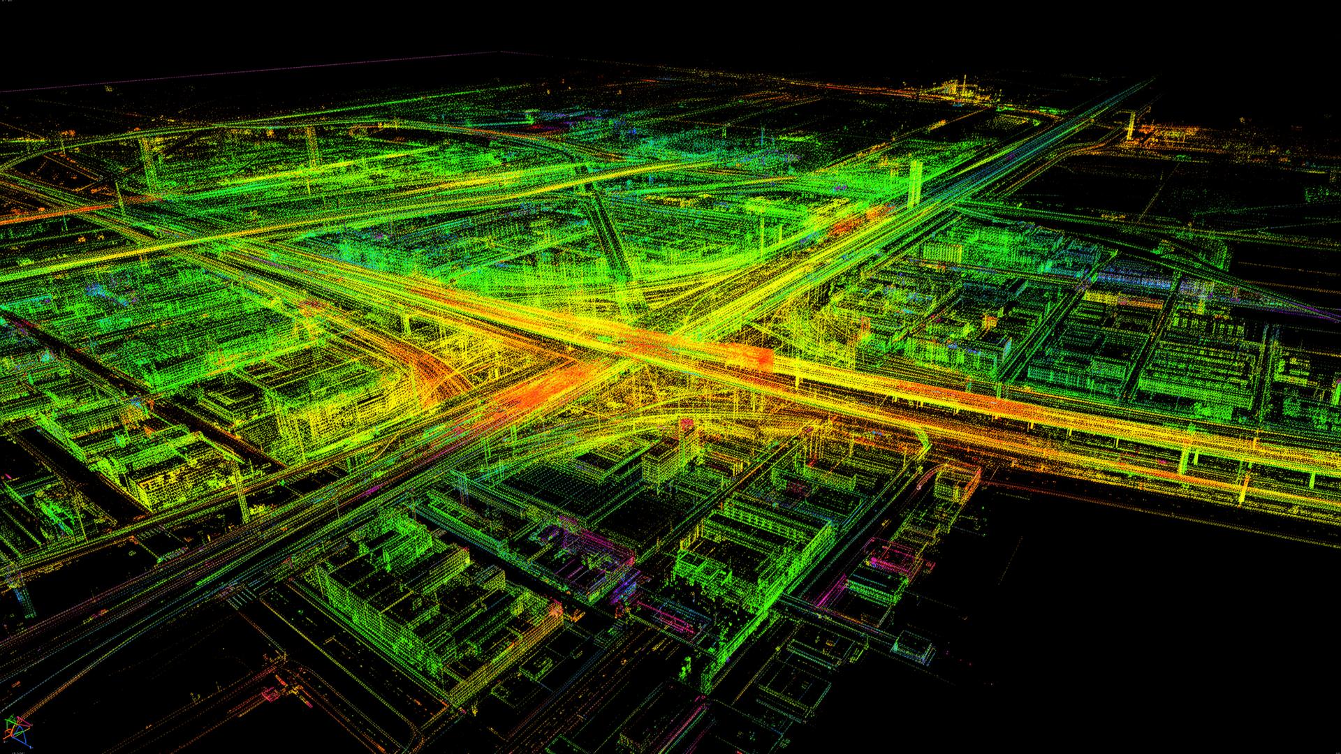
248M classified points

UAV LiDAR & photogrammetry
Power your project with our infrastructure.
From CORS subscriptions to managed processing — we operate the systems so you can focus on delivery.